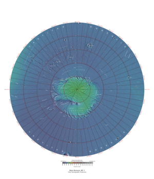
Mare Boreum quadrangle
The Mare Boreum quadrangle is one of a series of 30 quadrangle maps of Mars used by the United States Geological Survey (USGS) Astrogeology Research Program . The Mare Boreum quadrangle is also referred to as MC-1 (Mars Chart-1). [1] Its name derives from an older name for a feature that is now called Planum Boreum , a large plain surrounding the polar cap. [2]
Page Revisions
| Year | Metadata | Sections | Top Words | First Paragraph |
| 2018 |
110195 characters 10 sections 28 paragraphs 27 images 262 internal links 20 external links |
hiwish 0.326 cap 0.308 dunes 0.260 boreum 0.244 hirise 0.214 dune 0.196 ice 0.187 program 0.182 sand 0.153 defrosting 0.148 side 0.142 windward 0.138 perchlorate 0.138 northern 0.132 view 0.124 |
The Mare Boreum quadrangle is one of a series of 30 quadrangle maps of Mars used by the United States Geological Survey (USGS) Astrogeology Research Program . The Mare Boreum quadrangle is also referred to as MC-1 (Mars Chart-1). [1] Its name derives from an older name for a feature that is now called Planum Boreum , a large plain surrounding the polar cap. [2] |
|
| 2017 |
106682 characters 10 sections 25 paragraphs 25 images 262 internal links 17 external links |
hiwish 0.310 dunes 0.279 boreum 0.262 cap 0.255 dune 0.211 hirise 0.203 program 0.174 sand 0.165 defrosting 0.159 side 0.152 windward 0.149 perchlorate 0.148 ice 0.146 mare 0.123 defrosted 0.120 |
The Mare Boreum quadrangle is one of a series of 30 quadrangle maps of Mars used by the United States Geological Survey (USGS) Astrogeology Research Program . The Mare Boreum quadrangle is also referred to as MC-1 (Mars Chart-1). [1] Its name derives from an older name for a feature that is now called Planum Boreum , a large plain surrounding the polar cap. [2] |
|
| 2016 |
97374 characters 9 sections 20 paragraphs 21 images 257 internal links 10 external links |
boreum 0.329 hiwish 0.285 cap 0.224 defrosting 0.200 hirise 0.186 perchlorate 0.186 dunes 0.175 dune 0.165 program 0.164 mare 0.154 defrosted 0.150 ice 0.140 boulder 0.136 frost 0.125 side 0.115 |
The Mare Boreum quadrangle is one of a series of 30 quadrangle maps of Mars used by the United States Geological Survey (USGS) Astrogeology Research Program . The Mare Boreum quadrangle is also referred to as MC-1 (Mars Chart-1). [1] Its name derives from an older name for a feature that is now called Planum Boreum , a large plain surrounding the polar cap. [2] |
|
| 2015 |
76782 characters 4 sections 6 paragraphs 8 images 227 internal links 10 external links |
boreum 0.469 perchlorate 0.265 cap 0.228 mare 0.219 pole 0.144 water 0.126 ice 0.120 vastitas 0.119 polar 0.119 borealis 0.111 swirl 0.107 ocean 0.106 collar 0.095 stokes 0.095 analyzed 0.094 |
The Mare Boreum quadrangle is one of a series of 30 quadrangle maps of Mars used by the United States Geological Survey (USGS) Astrogeology Research Program . The Mare Boreum quadrangle is also referred to as MC-1 (Mars Chart-1). [1] Its name derives from an older name for a feature that is now called Planum Boreum , a large plain surrounding the polar cap. [2] |
|
| 2014 |
73525 characters 2 sections 4 paragraphs 9 images 227 internal links 9 external links |
boreum 0.391 perchlorate 0.309 cap 0.266 mare 0.154 ice 0.140 vastitas 0.139 borealis 0.129 swirl 0.125 collar 0.112 stokes 0.112 analyzed 0.110 218830 0.107 250778 0.107 phoenix 0.106 polar 0.104 |
The Mare Boreum quadrangle is one of a series of 30 quadrangle maps of Mars used by the United States Geological Survey (USGS) Astrogeology Research Program . The Mare Boreum quadrangle is also referred to as MC-1 (Mars Chart-1). [1] Its name derives from an older name for a feature that is now called Planum Boreum , a large plain surrounding the polar cap. [2] |
|
| 2013 |
72670 characters 2 sections 4 paragraphs 8 images 227 internal links 9 external links |
boreum 0.391 perchlorate 0.309 cap 0.266 mare 0.154 ice 0.140 vastitas 0.139 borealis 0.129 swirl 0.125 collar 0.112 stokes 0.112 analyzed 0.110 218830 0.107 250778 0.107 phoenix 0.106 polar 0.104 |
The Mare Boreum quadrangle is one of a series of 30 quadrangle maps of Mars used by the United States Geological Survey (USGS) Astrogeology Research Program . The Mare Boreum quadrangle is also referred to as MC-1 (Mars Chart-1). [1] Its name derives from an older name for a feature that is now called Planum Boreum , a large plain surrounding the polar cap. [2] |
|
| 2012 |
71177 characters 2 sections 4 paragraphs 6 images 225 internal links 9 external links |
boreum 0.391 perchlorate 0.309 cap 0.266 mare 0.154 ice 0.140 vastitas 0.139 borealis 0.129 swirl 0.125 collar 0.112 stokes 0.112 analyzed 0.110 218830 0.107 250778 0.107 phoenix 0.106 polar 0.104 |
The Mare Boreum quadrangle is one of a series of 30 quadrangle maps of Mars used by the United States Geological Survey (USGS) Astrogeology Research Program . The Mare Boreum quadrangle is also referred to as MC-1 (Mars Chart-1). [1] Its name derives from an older name for a feature that is now called Planum Boreum , a large plain surrounding the polar cap. [2] |
|
| 2011 |
51283 characters 9 sections 30 paragraphs 13 images 99 internal links 10 external links |
cap 0.362 ice 0.294 polar 0.189 boreum 0.186 boreale 0.171 polygons 0.163 soil 0.158 calcium 0.153 layers 0.138 fingerprint 0.128 carbonate 0.127 phoenix 0.126 mare 0.122 ph 0.122 tilt 0.114 |
The Mare Boreum quadrangle is one of a series of 30 quadrangle maps of Mars used by the United States Geological Survey (USGS) Astrogeology Research Program . The Mare Boreum quadrangle is also referred to as MC-1 (Mars Chart-1). [1] |
|
| 2010 |
47343 characters 9 sections 30 paragraphs 13 images 96 internal links 7 external links |
cap 0.363 ice 0.294 polar 0.189 boreum 0.186 boreale 0.171 polygons 0.163 soil 0.158 calcium 0.153 layers 0.138 fingerprint 0.128 carbonate 0.127 phoenix 0.126 mare 0.122 ph 0.122 tilt 0.115 |
The Mare Boreum quadrangle is one of a series of 30 quadrangle maps of Mars used by the United States Geological Survey (USGS) Astrogeology Research Program . The Mare Boreum quadrangle is also referred to as MC-1 (Mars Chart-1). [1] |
|
| 2009 |
38086 characters 9 sections 25 paragraphs 12 images 79 internal links 6 external links |
ice 0.316 cap 0.293 calcium 0.190 polygons 0.174 boreum 0.165 soil 0.164 polar 0.162 fingerprint 0.159 carbonate 0.158 phoenix 0.157 ph 0.151 perchlorate 0.131 boreale 0.128 dustier 0.117 patterned 0.115 |
Mare Boreum is a quadrangle that covers all the surface north of latitude 65° on Mars . The quadrangle includes the north polar ice cap. The Phoenix lander landed in the Mare Boreum quadrangle at 68.218830° N and 234.250778° E on May 25, 2008. |